Wednesday, October 29, 2014

Day 44 - Morganza to St. Francisville

Today is short. Very short. Less than 30 miles.

Since it is such a short day we agreed to leave together at 7:30 and stop for breakfast in New Roads.

We did this and ended up eating at the Main Street Cafe in New Roads. It was very small but served a good breakfast. After loitering there for as long as we dared we got back on the road.


The big deal today is crossing the Mississippi River.

Approaching the bridge.


Halfway across, time for some pictures.


'


We are staying in Motel in St. Francisville tonight and some are going to New Orleans by van in the the morning to return the next day. So we get 2 rest days in a row.

After getting in and taking a shower, I rode around town a bit. There really isn't a huge amount to see close to where we are staying. I got some lunch and proceeded to update the blog.


Day 43 - Chicot State Park to Morganza

Because of poor options for camping we are going to Morganza today, which is reportedly about 80 miles. This will make our ride into St. Francisville very short.

The ride started out pretty well with decent roads, but we soon encountered several roads that were quite rough.

At one point the route wanted to take us on the old LA 1 highway, which was decidedly a poor road with very little traffic, probably because no one wants to drive on it, A couple of us decided to use the main highway, which had a wide shoulder, but it had regular cracks in it that made for a somewhat less than pleasant but safer ride.

When we crossed the Atchafalaya River at Simmesport I decide to follow the levy road instead of staying on Highway 1. Here is a picture of the Atchafalaya River.


While the road was somewhat interesting it was really just a view of the levy on one side (no view of any river) and farmland on the other. And the road deteriorated the further along we got. I felt really beat up by the time I got to the opt out option at Innis. Which I took. It turns out that staying on 1 you have mostly a really good shoulder most of the way. It only gets a little bad where the prescribed route joins back up with 1.

This is the Simmes mansion.


Along the route we met a family 3 kids, 2 riding their own bikes and one pedaling on a tag along bike. They were from Quebec and had been on the road for 4 months doing about 25 miles a day.

The road along the levy getting close to Innis.


After Innis I encountered a group of supported cyclists doing a tour that was to end in New Orleans. They were headed to St. Francisville for the night. 4 of them passed me a few miles out of Morganza. I was surprised that I was able to hold their wheel and drafted off of them the rest of the way into town.

It turns out that the route was more like 75 miles, less if you take a few shortcuts, which I would recommend on this section.

We stayed at the Maxey Care RV park. Which was fairly good, but pretty far from the best we have seen.

There we met a couple of girls who started out on the Trans America route but then detoured south because the weather was getting cold. We had a lot of extra food so we shared what we had with them.

We also were able to see some fine specimens of "lean" beef. These are cows bred with 2 legs shorter than the other so they can more easily graze the levy. These were apparently bred with the "side hill gouger" by ranchers many years ago.


Day 42 - Oberlin to Chicot State Park

Today is a bit long with a need to haul groceries from a few miles out into camp due to a lack of closer facilities. The plan is to meet at Walmart in Ville Platte to help the cooks haul groceries.

Here we are in Oberlin getting ready to leave. Note the cell tower in the background. I could get a 4G signal in the parking lot but almost no signal in my room.


It was another slightly foggy morning as we got on the road.


Today we started to see the ugly underbelly of Louisiana roads. We hit some short sections that were very rough. Point of reference, if you seal coat a road, you do need to seal coat it again later on as the paving will eventually crack and become worse that riding on a dirt road.

But for the most part it seems like the roads here are on average as good as other states so it isn't all that bad.

We again hit some relatively less traveled farm roads with no shoulders. Which kind of irks me because many people think these roads are safer. They are not. Often you have large farm trucks driving these roads as well as cars with drivers that don't think cyclists should be on their roads.

The first rule of a safe biking road is to have a shoulder at leaf 18" wide, more is better, that allows cars to pass without having to cross the centerline, because even on these less traveled roads you do get traffic in both directions.

In any case some of the roads did have good shoulders and for the most part the traffic was well behaved.

Bikes lined up outside Wallmart waiting to carry some groceries. 


We camped in Chicot State Park (the "t" is silent). Next to a swamp.


Ron found this big spider hanging at about head height in the trees. Not sure what kind it is, but it was about 2" long and quite colorful.


This is the lodge we stayed in. It took a long time for them to cough up a key so we could get in though. I wasn't particularly impressed with the service. The lodge was well constructed though and quite comfortable, although there were not quite enough beds for everyone so some slept on the floor or outside.


We had a very weak cellular signal here and no WIFI so I didn't get a chance to catch up on the blog.

We had some raccoons come visit in the night. They started to go through some open panniers, but Daryl who was sleeping outside heard them and took care of things.

We also shared the house with a lot of cockroaches. I found a dead one in the morning next my bed. I think I stepped on it when I got up in the middle of the night to use the bathroom.

Overall it was a comfortable place to stay.


Sunday, October 26, 2014

Day 41 - Merryville to Oberlin

Today is another fairly modest 56 mile ride. The day started with the promised breakfast at 7 AM. It was good, but I ate too much and it weighed heavy for the first couple of hours of riding.

Surprisingly we did a fair amount of climbing, but none of it was very steep.

Today was mostly a repeat of scenery from yesterday, but with very few trucks, it being Sunday. It seemed like there was either a church or a Dollar General store every couple of miles.

In Oberlin we are staying in a motel by the tracks called the Oberlin Inn. It isn't the kind of place that I would pick to stop at when driving, but is clean and the proprietors are very nice.

We ate dinner in the parking lot.


Day 40 - Silsbee to Merryville

Today we say goodbye to Texas. So far we have ridden more miles in Texas than anywhere else combined. Over 1000 miles. The ride today ends, just inside Louisiana in a small town called Merryville.

The day started with an excellent wide smooth and relatively clean shoulder on a fairly busy 4 lane divided highway.

I started the day averaging a bit over 12 MPH. When I got to Buna I stopped at a convenience store and took off my cold weather gear.

As I was preparing to leave Mitch rode past. For some reason I got it in my head that I could catch him. After several miles of shadowing him and Daryl I caught up with them. I ended up passing them and didn't see them again until I got into camp.

The second part of the day was a bit slower when we got onto a fairly busy farm road without a shoulder. We started to see a lot of logging trucks hauling pine to be chipped. There were also the occasional chip truck hauling the chips to mills to make OSB sheets.

I eventually caught up with Dick who was taking off his cold weather gear. After I passed him I started to see a fair number of dogs that seemed overly interested in cyclists. One even came out from the other side of the road and caused one of the logging trucks to break hard to avoid hitting it. If you live on a busy highway, keep your dogs inside a fence. While I don't want to get bitten by a dog chasing me, I also don't want a dog to get killed because it decided that it likes to chase bicycles.

We eventually crossed the Sabine river and entered Louisiana.


I was told that roads in Louisiana were a lot worse than Texas. The few miles into the state seemed to confirm a somewhat less aggressive amount of maintenance, but the shoulder for riding seemed to be above average so the jury is still out on that one.

We are staying on the grounds of the Merryville Museum which has a fairly impressive collection of local artifacts. They like cyclists and have gone out of their way to make the location into a must stop for cross country cyclists that need a place to camp.


They cooked us dinner, Gumbo without shrimp, potato salad, cole slaw, fried squash and peppers, and desert. They also cooked breakfast for us the next morning.


Day 39 - ColdSpring to Silsbee

Today is a fair number of miles on paper, but we are getting into a flatter area of the country so it isn't expected to be particularly hard.

The day started, cold as usual, but having spent the night at Sunday Cottages we were able to get dressed and eat breakfast in the comfort of warm accommodations.

We left near dawn, the start of the ride, after leaving town was still through national forest land so was quite pretty to start out.

In Shepherd a large number of us stopped at a little donut shop for donuts and coffee. I had an apple fritter, which seemed like a pretty popular choice among some of the other riders as well.

After leaving the shop my legs felt pretty strong. Eventually, I started catching up to some of the other riders and managed to pull in sight of Ron. I did catch up with him briefly at a cross roads where he stopped because Shelly was stopped there talking to a couple of other cyclists. They had started in Phoenix and were doing the cross country piecemeal. I didn't quite catch where they were going after Silsbee, but my recollection is that they were going off route.

I continued to shadow Ron until Honey Island. Shortly before reaching that location Shelly caught up with me.

There was a store/sandwich shop at Honey Island that was very busy. The burgers were good there as well as the hospitality. It was a good place to stop.

Several of us ended up gathering there. I had a burger. Ron left well before the rest of us. As I left Sally and Daryl were ahead of me. I was having a good day and without many hills I was able to catch Sally and kept with her all the way into Silsbee. I ended up with an average riding speed of 13 MPH for the day, which is really good for me.

We camped at a fairly average RV park there called Red Cloud RV. There was a bar next door which we took advantage of for a few cold ones before later going out to a place called West Texas Barbecue for dinner.


Thursday, October 23, 2014

Day 38 - Roberts to Coldspring

Today we have a short day. About 48 miles to Coldspring.

The day started with the usual breakfast and lunch making activity, packing up and getting on the road.

The day dawned with a fair amount of cloud cover. Note the mileages in this picture. We are well over halfway.


The ride took us through the Sam Houston National Forest. It was nice riding through the forest.


Lake Conroe. It is nice to see large lakes again.


At New Waverly we had to take a detour to avoid some construction. I also went slightly off route before I realized that I was on the wrong road. But no by far.

The instructions for our destination were somewhat unclear from my notes so I ended up riding by the place, but not by far.

We are staying in a place called Sunday Houses, which are small but very nice cottages. Free laundry for us as well.


Beer has been obtained, a shower taken and time to catch up on the blog.


Day 37 - Carmine to Roberts

Today is again a long day. Nearly 70 miles. I'm on the cooking crew for tonight and we need to buy our supplies in Navasota which is over 20 miles from camp. Fortunately, for us the proprietor of the camp site agreed to drive into town and haul our groceries to camp.

There area a lot of nice ranches in this area. This place, which you can barely make out in the trees was particularly nice.


The main thing to note in this picture is that there are no mountains. But still a lot of up and down.


We have decided to bbq chicken tonight. I also bought beer again because I wanted to have some when I got to camp.

The day went pretty well. We had a lot of variable condition roads, but overall much better than yesterday. We are still hitting a lot of up and down, and we had some head wind which seemed to affect some of the riders more than others.

I made a couple of wrong turns which made the day for me end with a bit over 70 miles.

The first wrong turn occurred in Navasota. When I got into town I spotted Mitch and since I knew he was going to the grocery store I followed him. When he got to the edge of town he pulled over and I caught up with him. A bit of googling later and we determined that the store we wanted to go to was pretty much at the same location as I had spotted him earlier a bit over a mile back down the road.

We got to the store and then contacted Alisha who showed up after we had done part of the shopping.

The rest of the ride went well for me, except that I missed the sign at the campground. The name of the campsite is Check Point Harley. It caters mainly to cross country cyclists that are doing the southern tier. If you are going through this area it is a must stay place.


Day 36 - Bastrop State Park to Carmine

Today is a long mile day with over 60 miles estimated.

The day started with a pretty ride through Bastrop and Buescher State Parks. The road wen up and down a lot with some exceptionally steep, but thankfully short climbs. It was a pretty ride with multiple deer sightings along the way. Many pine trees. Also a lot of the area had burned in a forest fire fairly recently so there were lots of areas where all the trees were dead.


Here Jim Vincent is passing by me in the morning ride through the park.


After this we progressed on several farm roads, again of variable quality. It seems like the variety of ways a road is constructed in Texas is never ending. Some good, some not so good.

After getting to La Grange the road was exceptionally busy with lots of truck traffic. It also  had zero shoulder and one of those painted on rumble strips which forced us to ride further out in the traffic that would have normally been necessary. Be cautious on this stretch of road.

On the way out of La Grange I spotted this Texas Road Kill cleanup crew taking a siesta after a hard mornings work.


Later in the day we went through an area with a lot of Antique shops and places for vendors to sell their wares. It is apparently only open at certain times. There was nothing open when we rode through. This collection of pottery was pretty impressive.


I had to get my picture with this metal long horn sculpture.


We eventually reached Carmine and camped in the Dixieland RV park. It was pretty nice but it was a long walk to the showers and bathroom. Which made for a rather lengthy middle of the night trek.

There was a very nice store in town and I made a trip down there to procure beer for the group.


Day 35 - Austin to Bastrop State Park

Today we start riding again. On paper it is a fairly short ride. The first part of the ride we were kind of winging it based on being off route at the hostel. The ride started with several fairly steep short climbs.

After awhile it settled down but had a lot of twists and turns through some highly variable farm roads.  

Note the lack of mountains in the background. Still a lot of up and down, but only short climbs.


Just before getting to Bastrop the route went on a very unused road. Which translated into getting chased by several dogs.

At Bastrop I met up with Jim and John who had taken a more direct route along one of the main highways.

In Bastrop I apparently pissed off one motorist because I didn't immediately get onto the off street bike path which was not only not clearly marked but looked a lot like a sidewalk.

We camped in Bastop State Park. The shower/bathroom there was brand new and by far the nicest camp shower facility we have seen on the trip.

An RV, across the ravine from where we camped with colorful rope lights.


Wednesday, October 22, 2014

Day 34 - Austin Rest Day

Today was a rest day. After the long slog of climbs and many rollers getting to Austin it was a much needed day off.

What did I do I my rest day. First I slept in, not sure how late, but it was light out when I got up. A real change of pace.

First off I did laundry.

Later I walked down to Radio Shack and bought a USB charger and a battery pack that allows me to charge two devices at once and will, in theory charge my cell phone completely more than once.

I finally worked out when I would get together with my old National Instruments colleagues. Darren picked me up at the arranged time of 3:30 and then went to the Dog and Duck for drinks where Jeff, Jeff, and David showed up. We had a nice time catching up and chatting about nothing particularly earth shattering.

Afterwards Darren took me to dinner at Chuy's where I had a chuychanga with a side of hatch green sauce. We talked of manny things and then he dropped me off at the hostel.

It was a fine rest day.

Saturday, October 18, 2014

Day 33 - Johnston City to Austin

For me Austin is a major milestone. Yes we already made the halfway mark, but at Austin the terrain changes and it is also one of the few places on the route that I've actually been to before. Also I'm planning on getting together with some of my National Instruments colleagues from my stint with working there in the late 90's.

The route is something line 50 miles with a lot of rollers but no really long climbs.

The day started more or less like every day with waking up getting breakfast packing stuff and then getting on the road as soon as possible.

For some reason I slept poorly last night. I woke up frequently and didn't seem to get much uninterrupted sleep. I could blame the street lamp or the traffic noise but I've had those before. Maybe it was the Lobo beer I had. I only had one. Or maybe I just wasn't that tired. It was a fairly short day so I wasn't particularly worn out from riding.

I stopped at the start and picked up a Power Aid for later in the day.

Then started the ride and quickly ran into fog. We really haven't seen fog on this trip. As it turns out it wasn't a factor in riding. Here is what it looked like.


The ride was a lot of up and down. I don't think there was much at all where we were riding on the flat.

At one point we actually had to ride through some water.


As we got closer to Austin we started to encounter cyclists out for a weekend ride. A couple of them caught up with us and passed us just before they got to where their cars were parked. We talked to them and they gave us advice about the route into town.

Just before getting to town we encountered a short hill with in excess of 17% gradient. When I saw how steep it was I was surprised that I was still riding up it. But decided that walking was a better option and walked to the top. At the top I drank the Power Aid that I had purchased in the morning.

After that it was an annoying route into town with multiple unmarked streets at least a couple of wrong turns. But eventually we found ourselves in downtown Austin.

I had decided earlier that I would stop first at REI because my riding jerseys are in really bad shape. Surely a big town like Austin would have something. REI lived up to my expectations and I came up empty there. I did however find an inflatable pillow there so now I can stop stuffing clothes into a stuff sack for my pillow.

As I was leaving a couple stopped me and asked about my cross country ride. We talked a bit and they told me to try the Bicycle Sport Shop. I had previously noted that there was another shop called Jake and Adam's and they also mentioned Mellow Johnny's which was more or less on the way to the other two. I stopped at Mellow Johnny's but they had nothing that came close to being long enough. They tried to sell me a Jersey with their logo on it for $120. I told them no, they would have to pay me to be a riding advertisement for their shop. I was even more disappointed with Jake and Adam's shop. The Bicycle Sport Shop was only about a block away from there so I headed on down.

Luckily I found a couple of Jersey's that were long enough that fit well. They were both red, but at least I've got something that should last until the end of the trip.

After that I headed on down to the Hostel. When I arrived I was met by Jim Vincent who prepared dinner for us tonight. It was very good.

Tomorrow afternoon sometime I will get together with my NI buddies. I'll probably do some laundry in the AM.
 

Friday, October 17, 2014

Day 32 - Fredericksburg to Johnson City

Today is a fairly short ride of only about 43 miles. It takes us to Johnson City and yet another RV park. The Roadrunner RV park.

The ride was pretty simple nothing in particular that was of interest other than more hill country, more rollers, more Texas seal coat and poor road shoulders. Actually most of the road was pretty nice. At one point they were adding shoulders to the road and our side of the road had fresh smooth unadulterated by seal coat asphalt which was nice. Fairly little traffic a couple of short climbs that exceeded 10% for a bit.

I got into town, stopped at a DQ and had a Blizzard and then proceeded to camp. They have small club house here where I was able to catch up on my blog.

No pictures today, it was actually a pretty boring ride. As with all scenery in Texas on a bike you see enough of any of it to get bored pretty quick.

Tomorrow we head to Austin and another much anticipated rest day. After Austin the route becomes nearly flat all the way to the end so any climbing will tend to be very short. Probably quite a few rollers in places. The scenery should change a bit as well.

Max turned 25 today.


Day 31 - Lost Maples State Park to Fredricksburg

Today is a long day mile wise. It starts with one last big climb after which the map indicates mostly rollers with a bit of a climb after Kerrville. Reports vary on the distance. Anywhere between 75 to more than 80 miles.

The day started cold. We arose early doing most of our breaking of camp and getting breakfast before light. I hit the road just after light. True to the predictions of our map we hit a pretty long steep climb right away. Given how cold it was the effort of the climb helped to warm me up a bit, but I was still not particularly warm when I reached the top. The climb went well and then we got into some rollers.

Eventually we hit a junction and a couple of the riders were stopped there to take off cold weather gear. I did the same and then proceeded on.

There were a lot of high deer fences along this stretch. Some of them looked very expensive.

At one point I was on a downhill doing about 30 when I swear I saw an Ostrich on the other side of the fence. I considered stopping to get a picture, but the steep uphill ahead of me made me reconsider.

Earlier I did spot some deer. I got a picture in this case because I had just pulled over to check my tires after rolling through a pile of glass from a beer bottle. (Please if you are going to drink and throw your empties from the car, use plastic or cans.)

Later on I caught up with John and bob (his trailer) and asked him if he saw it. He said he didn't. For awhile I was starting to think that maybe I've been on the road too long.

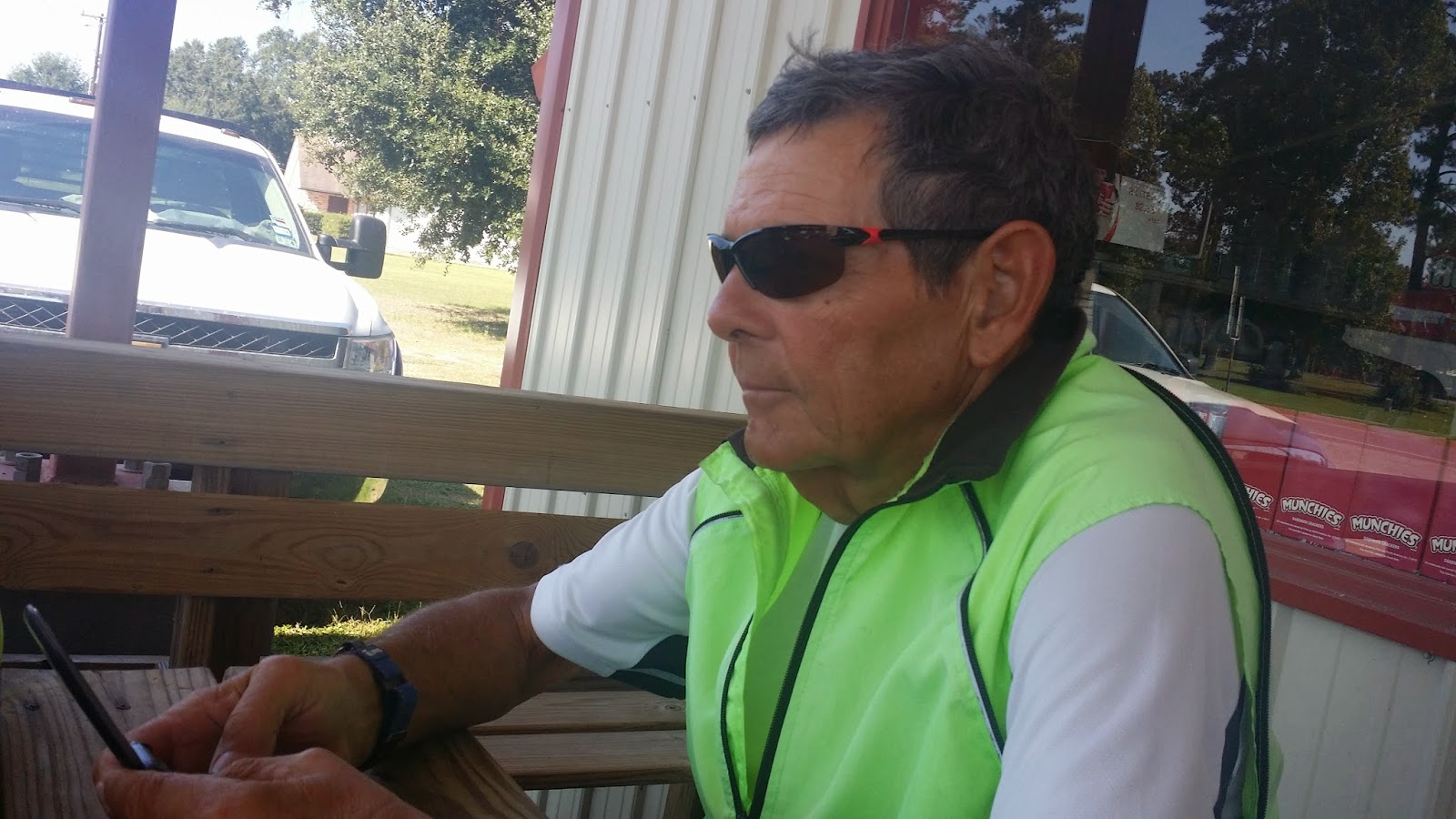
When we got to the town of Hunt I was ready for a break and as I rolled into town there was a place called "The Store" which had a bunch of our groups bikes parked out front. I stopped there and had a chopped beef sandwich and some tea. I also queried some of the riders that arrived after me if they had seen the Ostrich. Indeed they had, so my sanity is no longer in question. Some even claim to have photos.

At this point we were riding along the Guadalupe river. There were lots of big oaks and other trees that shaded the route, which made it quite pleasant.

At one point we saw this fence with many shoes on the posts.

When we got to Kerrville the route was convoluted and took us quite a ways off course through town.   I made a wrong turn along the way ending up going along the main highway instead of getting off route. The main highway was actually pretty nice with a smooth and usually wide shoulder.

I knew that there was a cutoff on Harper Rd. that I could take and when I found Harper Rd. I took it. The route was pretty good and I would highly recommend it if you don't want to go through town.

After crossing the freeway we mad a right onto a Ranch Road and hit a very steep 14% gradient climb. Fortunately it was short, but it was challenging. The road was nice and took us through and area that looked like very high end ranch homes. It really looked a lot like some rich dudes driveway.

The road was a reasonable seal coat using what appeared to be crushed basalt. Eventually the road changed color because the seal coat rock changed to crushed limestone. From here on the road started to look more and more desolate. Winding around and up and down. The homes started to look less upscale.

At one point we rode past a house with at least a half dozen cats outside sunning and cleaning themselves. There were also an equal number of cars.

Later on the road approached another house and then diverted to one side going between a fenced yard and an outbuilding. It really looked like the road was a continuation of a driveway that went on out into the back of some guy's property.

It was around here that I swear I thought I started to hear banjo music.

From here on for awhile the road started to look more and more like a farm access road that one would find on some private property. All the while the surface remained reasonably smooth but there were a lot of ups and downs that required significant breaking. In a couple of cases it looked like I could have gotten some serious air if I hadn't ridden my brakes.

Eventually it started to look a bit more like a real road with significantly long straight sections.

When we got to a place called Morris Ranch I took a picture of some buildings. I also took another shortcut to get to our camp site ending the day with about 74 miles of riding.


We stayed at the Lady Bird Johnson Park. The facility was nice but lacked reasonable access to electricity for tent campers. I ended up having to sit by an ice machine on the ground plugged into a spare outlet behind it to charge my stuff up and do some of my blog.

For such a long day I felt very good at the end. I'm starting to think that I'm finally getting into good shape.

We are officially halfway. To celebrate we went out for pizza and beer at a local pizza shop about a mile from where we camped.

Day 30 - Big Oak River Campground to Lost Maples State Park

Today presents several steep climbs, but is fairly short milage wise.

I started the day tired from the prior day. I'm not sure why but it turned out that I had a pretty good day. The day started quite cold and I ended up hitting the steep part of the first climb before I stopped to take off my cold weather gear. I was going good so I did the whole climb with it on. By the time I got to the top I was sweating pretty hard.

A view of Texas hill country. Most of the time it looks more or less like this, except that it is usually fenced to keep the deer in.


The top of the climb had a lot of fairly significant rollers and then a sweet down hill. The road surface today is a hair better than yesterday with the steep sections tending to be older seal coat which has gotten fairly smooth. With no shoulder we were riding in the traffic lane which wasn't a big deal because traffic was light and for the most part courteous. But as in all states Texas has some bike unfriendly drivers. A couple of times I was passed by what looked like people driving a fleet of new cars somewhere. A couple of them didn't give me much room and they were bunched up.

After the first climb we stopped in a town called Leakey and I had a burger at the Bent Rim Grill. A definite place to stop if you need something to eat there. It is a Biker (motor) joint but very friendly. A lot of motor cyclists ride these roads so expect to see a lot of them.


After that we had back to back steep climbs and then a descent down to a junction in the road where there was a nice little store with wifi. I drank a Gator Aid and some chocolate milk and sat out front and did a quick catch up since we had no good cell service from Verizon in this area. Other providers were poor but occasionally available.

Most of the climbs the road looked like these two pictures.


We then proceeded the final 4 miles to our camp site at Lost Maples State Park.