Sunday, September 28, 2014

Day 13 - Safford to Three Way

Today is in theory an easier ride. Just over 30 miles with a decent climb just before we get to Three Way.

For me the day started out with me having a hard time eating. I managed to eat some breakfast but it was difficult. I fixed my flat from the prior day. An extremely small hole that required immersion in water to find. I'm not sure of the cause. I found one slit in the front tire, but it didn't look like it went all the way through.

I was the last one out. As soon as I hit the road I found that we had the same headwind as the prior day. When we got to the point that 191 turned off the wind became somewhat of a side tail wind so it was an improvement. 

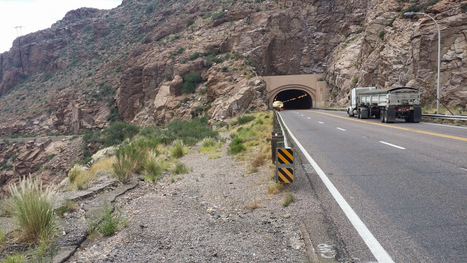
I knew as soon as I started riding today that I was not fully recovered from the prior day. The route north was somewhat uphill with an obvious up tick in the grade in the visible distance.

Looking back down the hill. Probably about 3/4 of the way up.

I made frequent stops along the way and was not making the kind of progress that I thought I should. Just before I hit the hill I noticed an SUV with a bike rack on the back slow down as it went past. After climbing the first bit of steeper slope I noticed the same SUV on the side of the road. I stopped and talked to a very nice lady Judy who was doing support for her husband and another rider that are doing the Southern Tier ride without carrying all their gear on their bikes.

She offered me water, Gator Aid, and food. I initially declined, but then thought better of the Gator Aid and took her up on the offer.

After chatting for a bit I noticed one of the riders approaching the bottom of the bit that I had just climbed. I decided that I would move on, thinking that they would surely catch me before the top some several miles of climbing ahead.

They never did, but what did happen was that I felt like I was strong again and the hill went smoothly after that. On the other side I stopped at the store in Three Way and had a soda while talking to Hal and Shelly who were hanging out at the store. The camp site is visible from this location, about 100 yards to the south.

Here is Judy with her support vehicle in the background.


While hanging out there an interesting guy in a beat up old pickup rolled up and started talking to me about the solar panel on my bike. It turns out he is off the grid with his own solar powered set up where he lives. He gave us a couple of pomegranates and as he was leaving Judy and her husband Roger rolled in. I bought him a soda in thanks for the help.

We also see a fair number of these quite colorful grasshoppers along the road. This one is about 2 inches long.

She is also blogging about the ride here.

The day is almost done. Dinner was excellent and we are going to the store for ice cream for dessert.


Day 12 - Globe to Safford

Today is a long ride, mile wise. 71 miles, in theory.

The day for me started pretty good. The first 20 some miles went by pretty fast even though there was some climbing. But then the head wind kicked in. It was probably 10-20 MPH and continued all day.

Along the way I noticed a cell phone battery and then I saw the phone. I stopped and picked up the battery, which was pretty beat up and the phone, which was missing the back. Surprisingly the phone worked. My plan is to drop it off at the first Verizon store I see, but it is likely that no one wants it as it was very beat up.

After hours of riding I eventually arrived at Pima with Phil and Max. I stopped to get a bite to eat but it was already getting dark. After eating I set up my lights on my bike and helmet and started riding. A short way down the road I noticed that my front tire was going soft. So I stopped on a corner where there was a street light and started fixing it. A police car stopped to see if I needed help. At that point I declined as I thought it would be a quick fix. Pretty soon it became apparent that the leak was very slow and then a nice gentleman name Lee stopped with his truck and offered to help. I decided that it was time to call it a day and accepted his offer to drive me to the end, at this point it was probably less than 10 miles.

He did so and refused any offer of gas money because, as he put it, he has been in the position of needing a ride and not able to get one in the past. We did make a couple of wrong turns getting to the camp site but made it there eventually. It was a very hard day. 

Tomorrow is a shorter day so we are going to get a slightly later start so we can rest up. Had pizza delivered for dinner which was good. My appetite is still not very good. I tend to get full after eating about half of what I would normally eat.

We stayed in a nice spot as you can see from this picture I took the next morning. We didn't put up tents but instead stayed in the recreation room of the RV park.


Day 11 - Apache Junction to Globe

Today's ride is from Apache Junction to Globe. Some significant climbing along the way. I think it ended up being something like 4000 ft of elevation gain.

The day started hot. I woke up sweating. The good news is it is supposed to be a lot cooler in Globe.

For me the first part of the day was hard I think mainly because of the heat. I spent quite a bit of time in Superior at a small Restaurant. Phil and Max joined me just before I left. They caught up with me near the tunnel on the climb out of Globe.

This is a climb you should avoid (in my opinion) because it is simply too dangerous. There is heavy traffic and mostly no shoulder. A short distance out of Superior you need to travel through a tunnel. While this is somewhat unnerving because of the noise of cars, it didn't seem like the worst part of the ride for danger.

Phil and Max coming through the tunnel. As you can see there is no shoulder, which is typical of the whole climb where there is a passing lane, which everyone seems obediently to stay in even if there is a cyclist on the road.

From where I took this picture there was a truck broke down. Apparently they blew a radiator hose trying to pass one of our group earlier in the day.


It took me a long time to do the climb and Phil and Max fairly quickly left me behind. At what seems like the top we were welcomed by this sign. To which I reply "lies all lies". It was actually about a mile of downhill, followed by another few miles of uphill, some more downhill, another sign promising may miles of downhill, and then more uphill. By the time I saw the last one I didn't believe a word of it, but indeed there was more downhill. At one point I was keeping pace with traffic, so moved to the center of the lane. Cars still wanted around me to try and fit into the safe following distance I had.

It was shortly after this point on a downhill that a white Van came within inches of me. Bernoulli effect notwithstanding a mirror passing mere inches away from your shoulder is unnerving.

Drivers, please give cyclist 3 ft or slow down and wait until you can. 


In Globe we stayed at the community center. They had a pool. But it was empty. We camped out in the park there. We had some clouds and before I got to Globe there was evidence that it had rained as there was still water puddled in the rumble strips.


Thursday, September 25, 2014

Day 10 - Phoenix to Apache Junction

Today we leave Phoenix.

That isn't to say we are out of town yet. We made it to Apache Junction. City all the way. Stop and go with a long ride through the Mesa residential dessert. No convenience stores and we found a park with a water fountain behind a locked gate. I didn't like Phoenix, but Mesa is not bike friendly on hot days.

I also started the day with another flat. Picked up a self tapping sheet metal screw. I was able to patch the tube without taking the tire off the bike so got going fairly quickly.

We stopped at a couple of parks along the way to refresh our water and rest.


I spend most of the day riding with Hal who bunked with me during the rest day.

We climbed a little, but nothing that you would call a hill. The day was very hot and had many stop lights and signs to negotiate which made it somewhat hard for me.

Stopped at  a gas station after traversing Mesa and bought a gallon of water to replenish what I had drunk and some that I dumped because it was hot.

I then stopped at a KFC an had sandwich and cooled off a little before riding the final 3 miles into camp.

It is very hot here tonight. Hope I can sleep. Tomorrow is a big climbing day with a couple of places with limited water stops and a tunnel. But we are going into cooler territory so hopefully it will be easier.


Day 9 Rest DAY

Today was a rest day in Phoenix.

Got a phone call to the room at 1:15 AM from somebody who was looking for a spanish couple. Don't know what was up with thaat.

Breakfast at Ihop. Then a trip down to the Slippery Pig bike shop to pick up a new mirror an extra set of gloves and get some things fixed on my bike. They ended up replacing the shifter cable for the rear and fixed up a few other odds and ends. The bike shifts better now.

Ended up riding about 12 miles for that.

Then I packed up about 10 pounds of stuff I don't need and mailed it home.

Then laundry and I caught up on the blog.

Yesterday Floyd Anderson contacted me about going to dinner. We went to dinner at Claim Jumpper with his wife and daughter and had quite a pleasant evening.

Sometime in the middle of the night a small spanish gentlemen knocked on our door asking if Tracy was in the room. Quite disturbing. He went on to another room and did the same thing. I still got plenty of sleep though.

No picture for the day. But here is my bike ride.


Wednesday, September 24, 2014

Day 8 - Wikenberg to Phoenix

Phoenix and a much anticipated, for me at least, rest day is our reward for today's ride. After getting up and getting breakfast ready we cleaned up, packed up and hit the road. Which is more or less down hill all the way to Phoenix.

The road was very nice, except for the normal bits and pieces of steel belted truck tires strewn along the side of the road. I managed to get a flat fairly early on. I stopped to take this picture shortly after Mitch passed me for the last time. A coyote ran in front of my just before this, but of course I didn't get a picture of that.

The haze in the distance is Phoenix.


After fixing the tire, which is a pain on a fully loaded touring bike. I got back on the road. Stopping once to wash my hands and drink a gator aid at a gas station and then later on in Surprise I stopped at a fast food place to use their restroom and drank a couple of glasses of soda.

After that I caught up with Alicia and we navigated the somewhat confusing streets and poorly marked bike paths of Phoenix. The maps have one name, but the  markings on the paths are different. I resorted to checking Google maps and my location on my phone to verify that we were on the right path.

Just before I arrived at the location where we were to turn off the bike path Alicia stopped to take a break and I continued on and soon found Hal sitting in the shade. We continued on to the Motel 6 and are now sharing a room.

Until I reached town I was averaging somewhere around 15MPH all the way in. The stop lights, and bike path slowed me down a lot after that. Still We arrived by about 1 PM. I spent the afternoon messing around with trying to update this blog. I finally found an app that I can use on my smart phone to make it a hot spot without paying something like an extra $60 a month to do it through Verizon. So far the wifi options at the locations we have stayed are mostly unusably slow.

Wen to Cafe Sarajevo for dinner last night. It was good. Eastern european type food. I had a Gyro sandwich and a beer. It was quite filling.


I was also contacted by an old friend Floyd Anderson who lives north of here and made plans for dinner tomorrow evening. Looking forward to seeing him again and meeting his family.

Breakfast in the AM will be at the local Denny's.


Day 7 - Salome to Wikenberg

It's hard to believe we have been doing this for 7 days. Today we go from Salome to Wikenberg.

Tonight Phil and I have dinner duty so we got an early start. I rolled out a few minutes before Phil. The plan is to see if there is a barbecue grill at our camp site and if so do hamburgers and potato salad.

Sunrise over the mountains.


Today's ride trends generally up hill all day with a downhill into Wikenberg at the end. But there is only about 1000 ft of climbing over about 45 miles of the ride so the grade is not much.

As expected the road conditions remained similar to the previous day. There was one section where it was dead straight for something like 20 miles. The scenery never changed the only way to measure progress visually was to watch the mountain range off to the left slowly move by.


This was the scene for most of the day. A long straight road disappearing over the horizon.


We camped at a very nice campground called the Horspatality RV Park. Of interest here is the proprietor was wearing a side arm. She was nice and very helpful. But the side arm was somewhat off-putting.

We camped on a very nice grassy area.


It turns out that they did have gas grill which required some creative methods of lighting. We used a cigarette lighter to light a stick on fire so we could light the grill as the push button didn't work.

We also were given a ride into town go get groceries by the husband of the proprietor. He was quite nice and gave us a quick tour of the downtown area on the way back to camp. If you ever need to camp in this area this is a very nice location and by far the best camping we have had on the trip so far.

We cooked planned hamburgers with potato salad and macaroni salad apple and pumpkin pie for dessert. No one complained so I think we did OK.

I was exhausted after that and went to bed as soon as I could. I woke in the middle of the night and took some Ibuprofen because my back was hurting. By morning it was feeling a lot better.


Day 6 - Quartzite to Salome

Today we left Quartzite and moved on to Salome. The ride was fairly easy but trended uphill all day. We started out on the freeway which wasn't bad and then had a bit of downhill trough the nice little wide spot in the road called Brenda that had a really nice store. They even provided ice water for us.


After having a pretty good day yesterday I was expecting this shorter day to be easy as well. But it turned out to be a bit harder due to a cross head wind and spending a lot of time in the heat.

When we arrived at hope I spent quite a bit of time resting in the shade before conquering the last bit of a climb. Saw this very nice corvette while resting here.


The last bit was not all that bad, 4 miles of climbing and then a short slight downhill into Salome. Where we enjoyed the accommodations at the Sheffler's Motel. It was probably nice at some point in the past, but I would not ever recommend it unless it was your only option.


There was a nice restaurant and bar across the street where Shelly bought me a beer for helping her out the day we rode into Palo Verde. All I did was give her a few Electrolyte tablets about 2 miles from the end. I figure I owe her a beer for noticing that I dropped my phone earlier that day. We had some chips and salsa and cooled off before dinner.

Ron and Mitch cooked up something that was quite tasty, pot surprise or something like that is what Ron called it.

Rumor has it that there were a couple of baby rattle snakes in the grass eating crickets, which were also infesting some of the rooms from what I hear.

It was a good day. Everyday seems to be hard but I am seeing signs of improved fitness that should make it easier in the days to come.


Sunday, September 21, 2014

Day 5 - Palo Verde to Quartzite

Today we go on to Quartzite via Blythe. Leaving California just past Blythe. The ride started with a flat decent road through irrigated farmland. And somewhat overcast sky.

For me the first few miles into Blythe I felt sluggish.
We crossed the river into Arizona via a narrow pedestrian walkway along the freeway. It had a rather poorly maintained approach. Which was steep so had to push the bike up. When I got to the top it was very narrow so I ended up walking across.

Halfway across is the Arizona California border.

After crossing the river we had an uphill along the freeway. Lots of trucks and lots of shredded tire carcasses to dodge. But generally a pleasant ride for me. I'm used to riding where there is lots of traffic. Especially with a shoulder wide enough to park a semi on.
The hill was fairly long but not steep. For the first time on this trip I felt pretty good on a climb. Probably mostly due to better temperatures due to the clouds.

At the top of the climb was our turn off to a side road down to Quartzite. The downhill had a few rollers but went by quickly.
Then I arrived at our accommodations for the night.
I stayed in the Black Pearl. My roommates. Max is on the right.
We went out for pizza at Silly Als.
It was very good. Then off to Dairy Queen for desert.

Tomorrow we go on to Salome.  Another fairly short day with some climbs.


Day 4 - Brawley to Palo Verde

Day 4, was hard.

I finally did get an early start rolling out the door before dawn to try and beat the heat.

About 5 miles down the road the sun came up.

Then we got into sand dunes and stopped at the Glamis store to get water.
The climb out of Glamis was fairly gentle passing by the chocolate mountains. Just past where this picture was taken we got into some rollers some easy some hard. Then past the border patrol check point where they waved me through. And then more rollers as we went downhill. There were a few nice downhill sections but always more rollers.

The day was hot and tiring. The sun really sapped my energy.

 At this point I was pretty tired so another 13 miles seemed like a long ways. More rollers followed.

Patty stopped after this post and I took on some more water and gator aid. I caught up with a couple more riders and we proceeded on. Finally reaching the flat of the the valley that Palo Verde is in.
I stopped at a rest area that had running water and refrigerated drinking fountains. As I rested in the shade there another rider Dave that isn't part of our group stopped. He is riding with a friend of Phil and Patty, Franklin and we waited until they showed up.

Shelly eventually showed up as well. Earlier I had passed her on one of last rollers and waited at the top where I somehow managed to drop my phone. She noticed it averting a somewhat major annoyance and expense.

I turns out we were only two miles from camp. So refreshed and slightly rested we pedaled into camp.


The camp hosts provided us a taco dinner. The town is starting to look like a ghost tow with the local stores and gas station closing.

I'm feeling stronger every day. But dreading what looks like another hard climb tomorrow.


Saturday, September 20, 2014

Entering Arizona
Pedestrian/bithe ccycle Bridge over the Colorado River

Day 3 - Boulevard to Brawley

Day 3 took us from near Boulevard to Brawley. 

For the first time on this trip I actually used my sleeping bag to keep warm as it cooled off nicely during the night.

This time I got the Garmin to work. The day started, with an uphill grind to get to Old Highway 80, which lived up to it's name as being old. The shoulder in places was unrideable because it was so badly cracked. More Border Patrol vehicles. There was some up and down to get into Jacumba which put us very close to the border. This is the best picture of the fence that I got. Off to the left. A rider coming down the road in the distance. Plus you can just make out a border patrol vehicle at the fence.


Then we had a bit more climbing. The following is close to the last hill before the big downhill on the freeway. Some cyclists are barely visible just going up the hill.

Then for the fun part. Down hill on the shoulder of the freeway. Which was well paved, but they did have a rumble strip. Mitch started down the hill just before I did. For awhile I wast sure I would catch him, but he slowed down for a police car that had someone stopped on the shoulder. I popped over the rumble strip and passed him. I passed a number of other riders on the downhill as well. At one point I saw a 50 MPH speed limit on a corner and checked my speed to make sure I wasn't going too fast. I think I was just over 45 MPH at that point. According to the Garmin I hit 50.3 MPH on the downhill along the freeway into Ocotillo.  Nice ride.

Unfortunately, the temperature continued to climb as we descended. It was well over 100 degrees in Ocotillo. I stopped as gas station and filled up with water and had a gator aid. From there until Plaster City the riding was fairly fast, but the road was quite rough. In plaster city Alicia and I sought out some shade from one of the buildings had something to eat and drink. We were soon told to leave and continued on our way.

From there until Seely I started to really feel the heat. I stopped in the shade of a tree for awhile. At one point the temperature on my bike computer registered 121 degrees. It was probably more like 105 but it really sapped my energy.


After that Max Phil and I stopped at a little air conditioned Taco stand in Seeley. Excellent tacos! They also filled our water bottles and my 64 ounce thermos. A cold drink on a hot day is really good.


From there Phil and Max headed into El Centro to stop at the bike shop.  I continued north along the designated route. Stopping frequently in the rare shade along that road.

About 1/4 mile out of town I had a softening rear tire. I tried adding some air but it was so hot I couldn't see myself fixing it. I proceeded to walk to town. In town I found an AM-PM mini mart and they were kind enough to allow me to fix the tire in the mens restroom. 

Refreshed after a nice rest in the AC I proceeded on to our Camp at the Lions Center. We actually camped inside of an air conditioned building. Although it again wasn't cold enough to use a sleeping bag.

We were also given some good information about the local fauna by Jack who was responsible for arranging the lodgings at the site.


Day 2 - Alpine to Boulevard

Day 2 was a relatively short ride mile wise but in theory more climbing than day 1. The day started with everyone trying to figure out how all this is going to work with cooking, etc. I started trying to organize my stuff so that it is quick to pack up but have not had as much success as I would like.

The route had a number of fairly difficult climbs along with a section on the freeway to start out. Some might think this was bad, but I think if you could stay on the freeway with the wide shoulder and pretty smooth pavement that it would be safer.

A view of our campground on the way out.


The day started with some riding on the freeway.  Quite a bit of uphill. There was a vista point that cyclists are required to exit on. You could just barely see the buildings in San Diego from here. 

After getting off the freeway we eventually made it to Pine Valley.  Mitch passed me on an uphill before I got there.

At that point he informed me that Jim Burke who I had the pleasure of riding wih for part of the first day had decided to abandon as well. He added a lot to our group with a unique outlook on things. After the first two days of very hot riding with a lot of climbing I think many of us have been challenged and at least speaking for myself I was close to my limit more than once.

 When I got into Pine Valley I first noticed some emergency vehicles on the side if the road. I hoped it wasn't one our group.  Unfortunately, it was. Clint had run into the back of a truck that was parked on the shoulder. He had his head down pedaling and didn't see it.

He appeared to be reasonably OK with a bandaged left arm from the accident, no apparent damage to his bike or the truck. The officer at the scene wanted Mitch's phone number.  Which he immediately called.  It turns out Mitch was just up the street in a local diner so he was able to ride back to the scene and took care of helping Clint get transportation.  As it turns out Patty, Phil's wife was driving Max to the next camp and then Jim Vincent back to San Diego.

At first it appeared that Clint was going to continue on the next day but eventually he made the decision to try and rejoin us in Phoenix.  I really hope that he can.

Here is a picture of Jim, on the left and Clint that I took in San Diego at the hostel.

After leaving Clint in the capable hands of Mitch and Phil I stopped at Majors Coffee Shop and had a half a sandwich and bowl of soup. The staff went out of their way to fill all my water bottles, with ice, and my 64 Ounce Thermos, which so far is looking like one of the best things that I brought as it keeps water ice cold all day.

After a climb out of the Pine Valley, which proved to be somewhat easier than I expected there was a nice long decent, including dodging a speed bump that the Border Patrol had in the middle of the road. It seemed like about every 4th or 5th vehicle was Border Patrol. Given how much they use that road you would think it would be better maintained.

Later on I saw Patty shuttling Clint and Jim back to San Diego. They told me to take Church road instead of the other one that we had planned on taking. 

About this time the clouds came in and just after Mitch caught up and passed me again it started to rain. Very pleasant!

Got to the appointed road and had a very nice fast decent. At the end of the road the decision was to turn left or right. I figured right, but took my phone out to check with google. I had a text from Mitch, turn right and about 1 mile uphill to the camp turn off.

Got my tent set up and a shower and dinner was ready. Need to get to camp earlier. Must get an earlier start in the morning.

Here is the route I took. Again, not from my Garmin. I need to pay more attention to what I'm doing I think.


Friday, September 19, 2014

Pacific Ocean Photos

We often see these wonderful starter photos where all those departing for their cross country ride are standing in a neat row ready to depart.  Getting these photos is not always as easy as you may suspect.  As an example look at the photo below. The rider on the far right is carrying his bike across the sand to the beach.  Yes skinny tires do not work well in the soft beach sand.  Now look at the two bikers with fully fully loaded pannier access to the beach was very difficult.  Now for problem number two notice the rider on the far left of the photo.  She is getting her picture taken and as she was waiting a wave came in and sunk her and her bike.  Yes wet shoes are not fun to ride in besides ocean water and sand are very difficult on those delicate bicycle parts.  One of the most difficult is to get someone to take those photos.  Thank you Patty for volunteering your services.


And here is the final result.  After 15 plus camera's where we needed to move forward four times we finely got our picture.  MB

Thursday, September 18, 2014

Day 1 - San Diego to Alpine

The day started with a quick stop at the beach.

The day was hot. 104 degrees. I was riding with Jim B. and Max. Jim was having a rough time with rhetoric hills and heat. He opted to get a ride into camp from a couple of nice girls in a pickup. Max and I declined. 
Earlier in the day Jim found this nice air condoned customer service location at Padre Dam. Vicki was very nice and we hung out here for a few minutes. Refilled water bottles and cooled down.


Many hours and one very wrong turn later.


 Getting to Alpine was good but there was a lot more climbing left. It was about 8pm when we got to the turn for the camp. Unfortunately we missed the second sign and ended up about a mile past where we needed to be before we got some good help from a guy at the fire station.
When we got to camp we received much help setting up tents from Shelly and Clint.

We also found out that Jim V. had decided to abandon after passing out at a convenience store. We are all sad that he had to leave.

Then a shower and off to dinner at the Casino.  Didn't get to bed until after 11.

Unfortunately The GPS track wasn't on my Garmin when I downloaded it. So the following is approximately, based on my memory and dead reckoning the route I and Max took due to me missing the turn off of Julian street. It comes in at about 50 miles instead of the planned route. Plus the ride from the hostel to the beach is not on this one either.

If you are planning to do this route I recommend downloading the GPS tracks from Adventure Cycling. I had them, but didn't use them. The really sad thing is that the mistake I made was not in a place that was at all confusing on the map. I just was not paying attention and assumed I knew where I was going. Sorry Max.